Case Study Barrio 31: A Measurement Case Study - Part 2
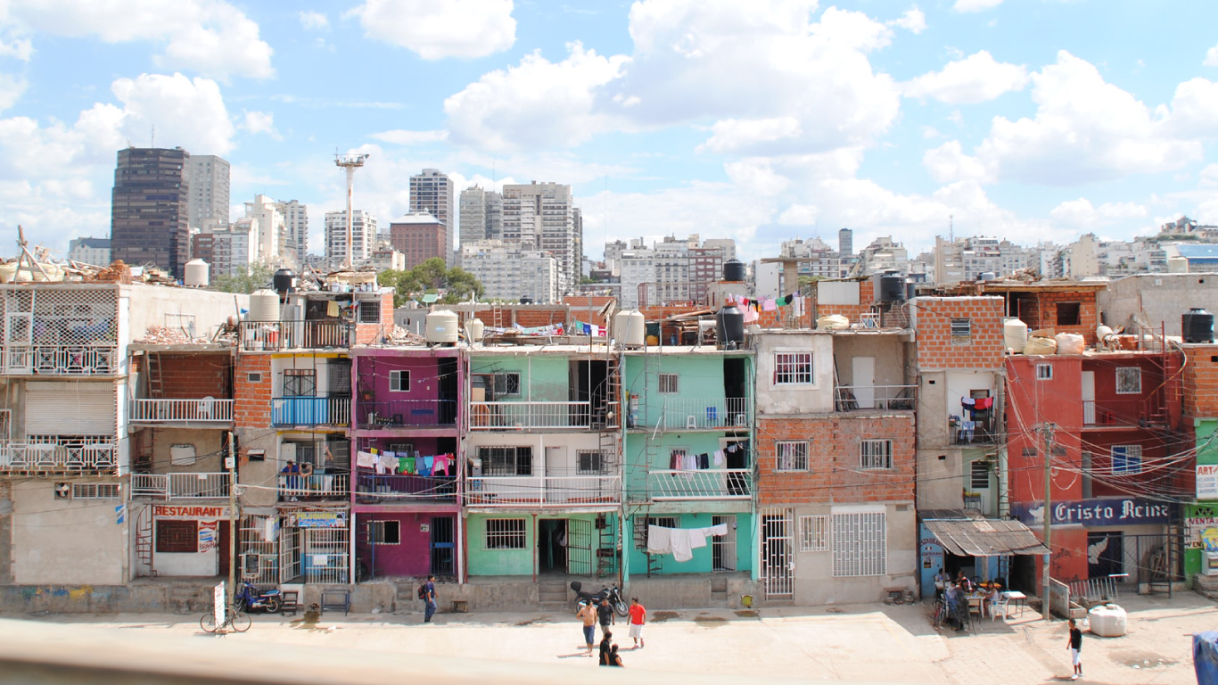
Recap: This post is the 2nd installation of our series of blog posts covering the Barrio 31 Project. Villa 31, one of the largest poverty-stricken neighborhoods in Argentina is undergoing a massive renewal into an official city neighborhood: "Barrio 31". Key project challenges include a lack of as-built documentation; the scope and size of measurements needed; a short project timeline; and the need for quality and consistency of data during hand-off.
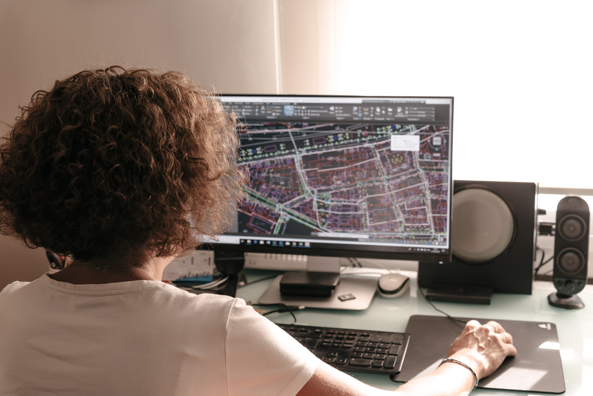
Our post today outlines the reality capture technology used to create point clouds and 3D drawings. We will also discuss considerations that had to be made for each followed by a guide of key takeaways you can apply to your next measurement project.
6500 smaller projects
In our last post, we discussed the challenges of manually creating models for all 6500 structures in the area and processes our software development team created to automate the rote parts of the workflow. What we did not bring up, however, was the fact that someone had to go visit the site and physically measure each plot.
Beyond the sheer effort of measuring 6500 structures, our technicians faced a number of other problems. Many of the buildings had elevated elements such as doors or windows that were difficult to scan from the outside. The streets were narrow with nowhere to park, so equipment had to be manually brought in and removed each day on foot which reduced the time available to measure.
Choosing the right tools
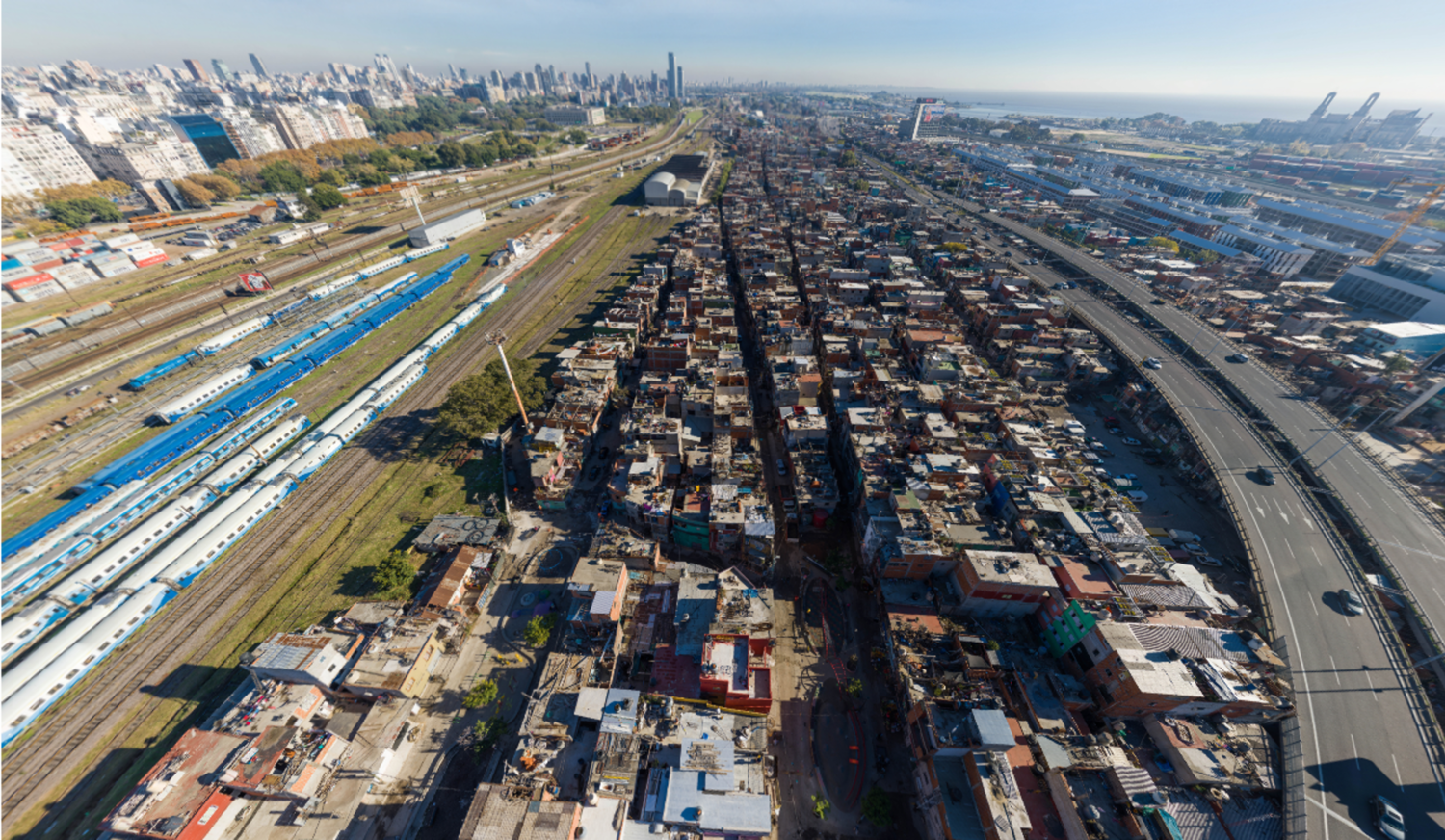
Project Manager Mariano Gerez decided that the team should conduct an aerial survey in order to quickly capture the roof plans. Even in an area this size, the full survey could be conducted in <1 day. However, Villa 31 lies directly adjacent to most of the major infrastructure in Buenos Aires including the port, train station, and airport. This meant that there were a variety of concerns the team had to address before even thinking about takeoff.
Proximity to the railway and port (much less the airport) meant that numerous permits would be required from the government. Multiple signatures were needed from several departments for each. Villa 31 also lies directly under one of the flight paths of Jorge Newbery International Airfield which meant that flights could occur only on days with good visibility when airplanes were approaching from the opposite direction.
Parallel Projects
In tandem with the aerial survey, our laser scanning team was hard at work on the ground to obtain measurements of the facade and other building elements. Terrestrial surveys take a significantly longer time period (in this case, 60 days, or 100-150x the length of the aerial survey), but also provide greater accuracy (down to 1/8" vs. 2-3"). The permitting requirements for a terrestrial survey are much lower than an aerial survey, but the survey itself also requires more manual effort to conduct.
The fact that the area had been built organically, not to code meant that there were many instances of areas that were hard to reach: doors that opened to the outside on the 2nd or 3rd floors, stairs leading nowhere, and other elements that were difficult to reach. Likewise, people lived and worked in the area, so gaining access could be difficult and working hours were limited by project sponsors.
Project Takeaways
-
If you want to conduct an aerial survey:
-
Check to make sure you are complying with all rules and regulations for the area you are going to fly over.
-
Find a good spot for your launch, especially if you are using a fixed-wing device rather than a quad or octocopter.
-
Double, then triple-check that there is absolutely no aircraft flying in your vicinity. You do not want to potentially endanger other aircraft.
-
-
Laser scanning on the ground:
-
Areas need to be clear when scanning. If possible, schedule for the time least likely to cause a disturbance to work.
-
Be ready to improvise in the case of hard-to-reach areas. Our team recommends bringing tripod extensions, ladders, and other platforms to get to tricky spots.
-
Weather is not your friend. If you're living in a climate such as LA that is consistently sunny you don't need to worry. The rest of us must plan for delays due to rain or snow.
-