At Voyansi we conduct several processes that involve the knowledge and skills of engineers, architects, industrial designers, and other professionals of the AEC industry. But despite the wide range of services we offer, there’s one that’s often in the spotlight: Laser Scanning. And it’s impossible to avoid asking ourselves why does that happen.
Let’s start from the beginning
Surveying is central within the construction industry. Knowing the key aspects of the place you are going to build on or of the building you are going to demolish or remodel is fundamental before defining the rest of the construction sequences.
There are several methods of surveying that today have been left behind due to the technological revolution that’s changing the paradigm in the AEC industry. Not only do new technologies save time and effort, but they also allow higher precision and more flexibility on each task involved in construction and design processes.
That’s where laser scanning comes into the picture
Surveying with a laser scanner is a much easier process than doing so with traditional methods. The results of laser scanning are also better in terms of precision, and this is due to the fact that it captures 3D data and turns it into a point cloud.
What can this point cloud be used for? By “connecting the dots” within it, you can create parametric 3D models that can serve various purposes:
- Having an accurate representation of the site’s existing conditions.
- Aid design processes.
- Function as a database to improve decision-making instances.
Of course, there are more than just these three, but let’s not lose sight of what matters most here: what’s laser scanning?
Beginners guide to laser scanning
First, “laser scanning” isn’t its actual name. If you want to get specific, its actual name is Light Detection and Ranging. But let’s keep it simpler today. These laser scanners capture the characteristics of any object they point at: From a glass of water to a building, these devices can replicate them in a colored or black and white point cloud.
How exactly do they work? Once you calibrate and set up your laser scanner, it will rotate 360° a pulsed laser light. It will do it fast, and the pulses reflected will be measured using a sensor. At the time of surveying, the scanner rotates around its vertical axis, and the beam is moved up and down by a mirror.
As the beam hits different objects in the environment, for instance, a wall, the scanner can measure the distance between it and the object. How so? By the time it takes for the beam to bounce back from the object’s surface. Now, that beam is reflected by a rotating mirror, which means that information about the site is captured in both the horizontal and vertical angle of the scanner.
Of course, being able to capture so many points enriches the point cloud and, consequently, the 3D representation obtained from it. But you can’t do all the work in just one scan, you must place the scanner in different places to capture all the sides of the same object.
But there’s a great question in the air right now: What range do they cover? Of course, the closer they are to the object the more detail they can provide, but they are also able to survey sites and objects from 2km away.
The product: Point Clouds
Laser scanners make multiple measurements, and all of them are translated into points. Each one of them represents its X, Y, and Z geometric coordinates on an underlying sampled surface. Taking that into account, point clouds serve as datasets that display all of those measurements combined. Of course, after a process called “registration”, the different points that are part of the point cloud are tied together, forming an exact representation of the site, object, or anything you’ve scanned.
But it doesn’t end there. Point clouds are far from reaching their peak. Developments in this technology are constantly being made. Their accuracy and size have room to improve and, since they are the go-to process for most of the BIM experts out there, the will to explore them will never cease.
And probably one of the aspects that will develop the most is point cloud processing. By developing machine learning algorithms, the need for human intervention in the alignment of the point cloud’s dots will be reduced. Of course, this will also translate into time and cost savings, smoothening a process that can only keep growing.
.png?width=760&name=unknown%20(5).png)
So, why should you choose laser scanning over traditional methods of surveying?
Well, most of these arguments come from logic. Having millions of points that together make up an exact representation of a site and object, brings better information that can be used for decision making. It’s exactly like having a digital map of your site that represents it as accurately as it’s technologically possible.
Also, if you compare laser scanning to traditional methods of surveying, you will see that they require less time and effort. Other methods are also more prone to inaccuracies since they rely more on human skills than on equipment deployment.
But aside from those two main benefits, let’s break everything down into the different construction phases.
If we start from the pre-construction stage, having a precise representation of your site and the possibility to envision a building in a digital environment before even breaking ground allows you to have a clearer picture of the future. This means that the risk of confronting unexpected challenges is drastically reduced.
Let’s move to the construction stage, here you can scan your progress and contrast it to the original design and plans to perform quality control. Of course, once you have reached the post-construction stage, scanning the building can provide you with valuable information to make as-built models that can later be used for remodeling or demolishing processes.
What Voyansi can offer
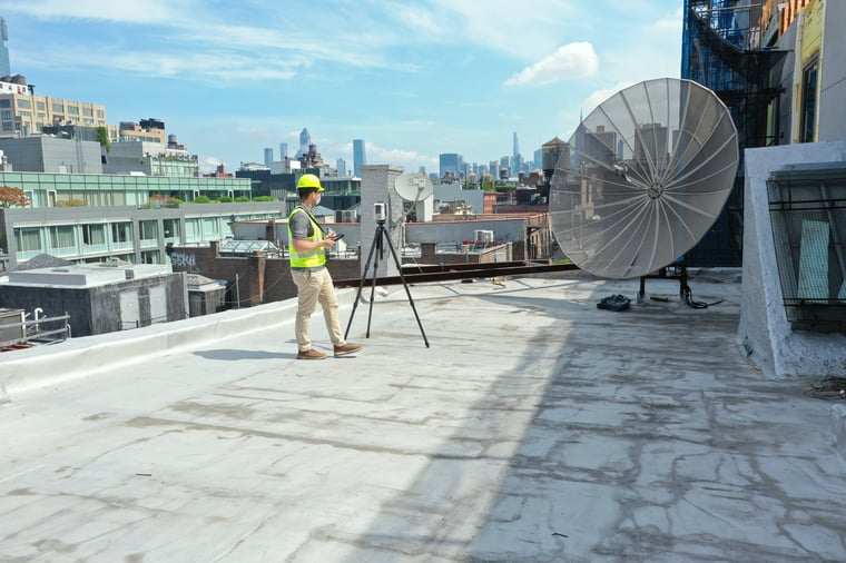
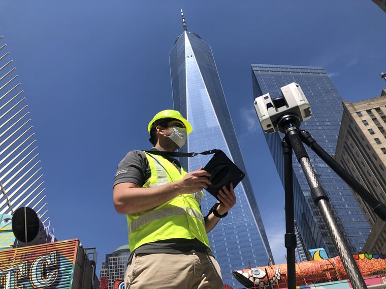
We have a crew of experts located in Argentina, Spain, and the US who can scan any site or building. Laser scanning is one of our most demanded services due to the quality of our deliverables and our experience scanning various types of facilities and environments. Check out our website to learn more about our services, and contact one of our experts for further insights.
Want to know more about how Voyansi can help make your digital transformation a success? Submit the form below to request a call from one of our experts.