Design

Reality Capture

Transforming the Richness of Real Spaces into Precise Digital Models

Reality Capture is a solution that allows existing buildings and infrastructures to be redesigned, maintained, and accurately transformed through advanced laser scanning. It gives architects and engineers an accurate base for surveys, heritage documentation, space redesign, and building remodeling.

Our Approach

Our approach involves using a comprehensive fleet of cutting-edge laser scanning technologies to deliver different outputs for existing conditions:

  • Point Cloud: Generating detailed spatially indexed point
    clouds to represent environments accurately.
  • 360° Picture Tours: Offering engaging interactive virtual tours
    using photogrammetric technology.
  • Scan to BIM: Creating comprehensive 3D BIM models of surveyed buildings and infrastructure in a variety of formats and detail scales.
  • As-Built Plans: Producing precise survey plans that reflect
    the constructed state of spaces or buildings.
  • Deviation Reports: Providing thorough documentation of
    discrepancies within scanned spaces.

Our OFFERING

  • International Coverage: Solutions spanning across the USA, LATAM, and EMEA.
  • Outcome precision: Delivery of precision-translated BIM models and drawings.
  • Technological Excellence: Utilization of industry-leading capturing equipment from Leica, DJI, Trimble, and more.

Value proposition

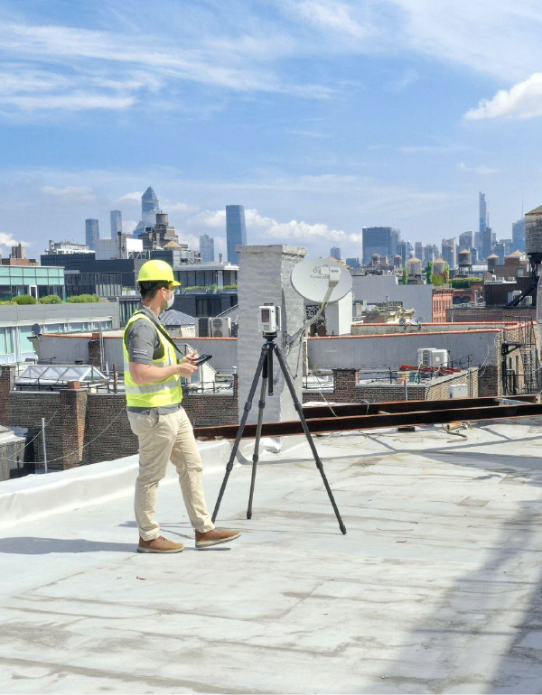
Voyansi stands out as a responsive, one-stop Reality Capture solution. We handle everything in-house, from capture to modeling/drafting, optimizing quality while cutting costs and time. Our large team manages significant projects, including airports and railways, with professional surveyors and state-of-the-art technology. As Hexagon partners, we enjoy direct manufacturer support, ensuring our BIM models are accurate and actionable for superior design foundations.